If you love hillside views and oak‑studded trails but worry about steep driveways, wind, or evacuation routes, you’re not alone. El Toyonal in northwest Orinda offers a dramatic setting with very real day‑to‑day tradeoffs. In this guide, you’ll learn what life on these hillsides looks like, how access and microclimate work, what to watch for in utilities and hazards, and how to size up a specific home with confidence. Let’s dive in.
Where El Toyonal fits in Orinda
El Toyonal is a hillside residential corridor in northwest Orinda that climbs from Camino Pablo into a network of winding streets, including Loma Vista and Vista Del Orinda. City street inventories classify segments of El Toyonal as collector and local roads, and some portions end at barricades. This helps explain why parts of the area feel like one‑way‑in, one‑way‑out enclaves. You can see the street layout and assessor plat context in county maps of the Orinda Park Terrace area. For a planning view of how these streets function, review the City’s circulation and street classifications in the Orinda General Plan and the assessor plat map.
City policy has long recognized the corridor’s slope and access constraints. The General Plan includes hillside slope‑density limits and notes that no major subdivision should proceed without specific road connections. These rules help explain the area’s mix of older lots and generally lower, varied housing density. You can explore the land‑use context in the Orinda General Plan.
Homes and lots on the hillside
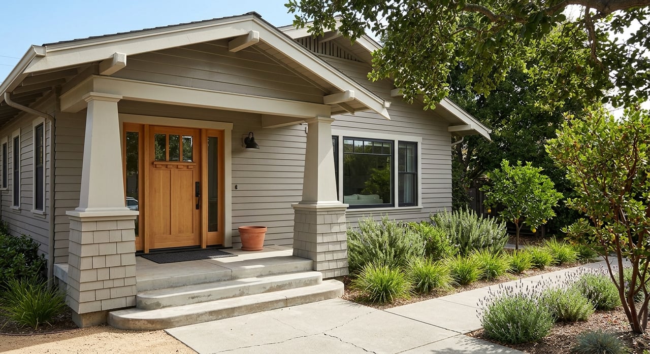
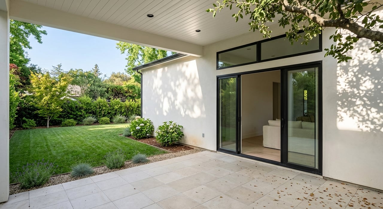
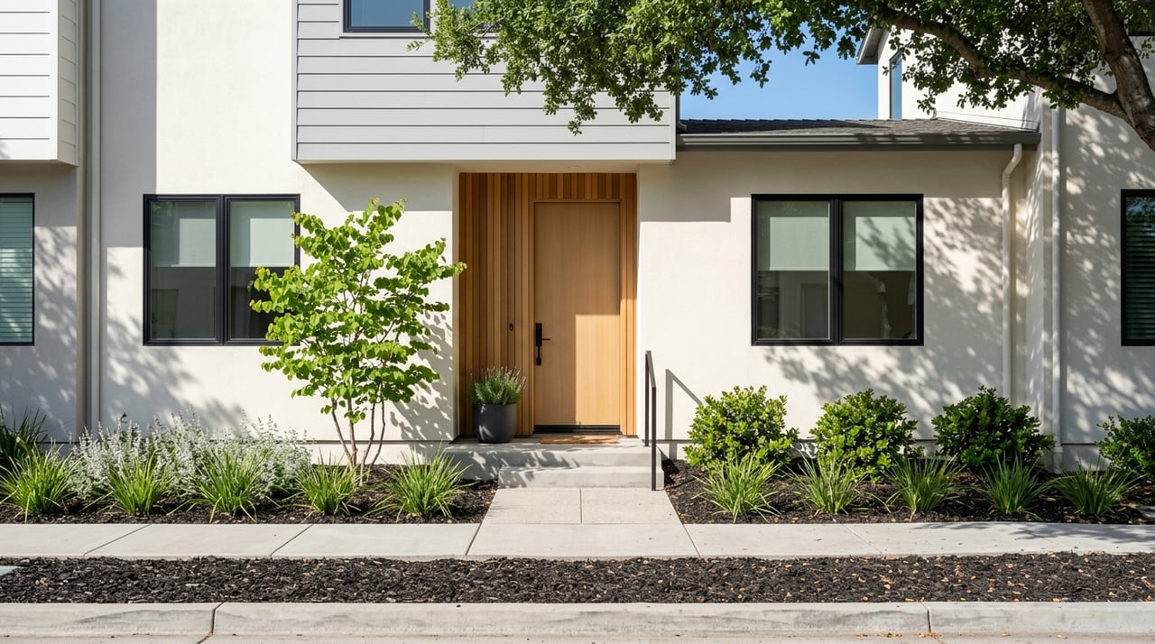
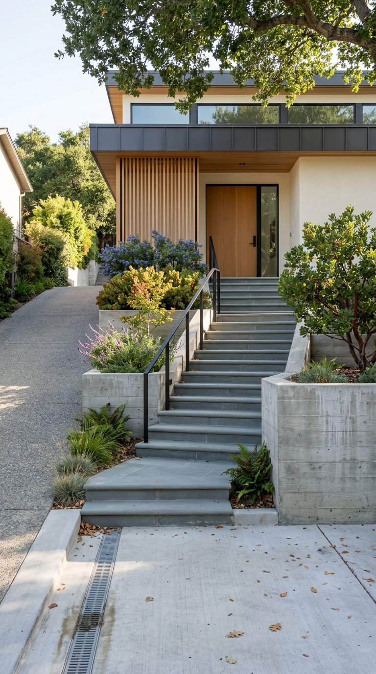
You’ll find an eclectic housing mix: mid‑century ranch homes on flatter knolls, remodeled mid‑century designs, and modern hillside builds that step down the slope. Many homes prioritize light and views with large windows and decks. Garages are common, but not always at street level, and many driveways are steep.
Lot sizes and topography vary. Parcels often slope, with terraces and retaining walls creating usable outdoor areas. On steeper blocks, decks and patios do the heavy lifting for outdoor living. Larger, flatter yards exist but are less common; expect practical, low‑maintenance landscaping where slopes are pronounced. Parcel maps illustrate the terrain and pad sizes in this area; the county’s assessor plat map provides helpful context.
A few features you’ll frequently see:
- Single‑level ranch layouts on flatter sites for easier daily living.
- Multi‑level homes with internal or external stairs between living zones and decks.
- Driveways and private inclines to reach front doors or garages, sometimes with limited on‑street parking.
- Solar and battery storage on some remodels, reflecting local resilience planning.
Microclimate and views
Microclimates shift quickly in the Berkeley‑Orinda hills. West‑facing slopes toward Berkeley can see more marine fog and wind. Sheltered knolls may feel warmer during the day, while exposed ridges cool off fast at night. For a regional primer on why orientations matter, see the Berkeley Hills overview.
Many homes feature hillside, valley, or reservoir outlooks. Actual views depend on elevation, orientation, and tree cover on and off site. If views are a priority, visit at different times of day and in multiple seasons to confirm what you’ll experience.
Getting around and daily access
Roads and driving
Camino Pablo is your main connector to State Route 24 and downtown Orinda. From most addresses along El Toyonal, you’ll drop to Camino Pablo for freeway access and errands. City documents note that some El Toyonal segments are local roads and that certain stretches dead‑end, which can concentrate traffic and make areas feel secluded. For circulation details, see the Orinda General Plan.
BART and regional connections
Downtown Orinda’s BART station is the primary rapid transit link to Oakland and San Francisco. Programs have historically managed station access and parking, which many residents consider when planning commutes. You can read more about station access initiatives on BART’s site.
Routes to Berkeley and the hills
Fish Ranch Road and the Claremont corridor connect Orinda to Berkeley. Wildcat Canyon Road is a favorite for reaching Tilden‑area trails. These are winding hill roads, so travel time varies with traffic and route choice. It’s smart to test your likely commute at peak times. For a regional network view, browse the county transportation authority’s corridor appendix.
Utilities and infrastructure
- Water: The East Bay Municipal Utility District (EBMUD) supplies water across Orinda and maintains hydrants and watershed lands that factor into wildfire preparedness. Confirm your service and hydrant locations with the City’s EBMUD resource page.
- Sewer: Many Orinda homes connect to regional sanitary systems rather than on‑lot septic. Always verify sewer status for a specific parcel during due diligence.
- Power and undergrounding: The City has studied and established utility undergrounding in select areas after local ignition events. Undergrounding can reduce exposed lines and potential wildfire ignition sources, but implementation is incremental. Read about the Camino Pablo/El Toyonal district in this Lamorinda Weekly report.
Hazards and resilience
Wildfire and evacuation
Northwest and central northern Orinda, including the El Toyonal hillsides, are identified in city and county planning documents as areas with elevated wildfire hazard. Portions of the city and adjacent open spaces are mapped in High or Very High Fire Hazard Severity Zones. Narrow, winding roads and dead‑ends can challenge evacuation. The City’s Hazard Mitigation Plan outlines risks and strategies; review the Orinda Annex for details.
The City also enforces special Red Flag parking restrictions on certain streets, including El Toyonal and Loma Vista. On Red Flag Warning days, stopping and parking can be limited to keep emergency lanes clear. If you have multiple cars or frequent visitors, understand these rules before you buy. See the City’s Red Flag Parking FAQ.
Insurance and PSPS
Hillside locations in the wildland‑urban interface may face tighter insurance underwriting and higher premiums. Obtain quotes early in the process so you can plan. Public Safety Power Shutoffs (PSPS) and weather‑related outages are noted in local resilience planning. Home features like compliant vegetation management, updated roofing, and battery backups can be meaningful mitigations. The City’s Hazard Mitigation Plan discusses these resilience factors.
Seismic and slope stability
The region is seismically active, and hillside parcels can carry landslide or slope‑instability risk, especially where drainage is poor. For steep or repaired slopes, a site‑specific geotechnical review and drainage evaluation is prudent. The Orinda Annex to the Hazard Mitigation Plan addresses landslide risk and development practices. Review it here.
Everyday living tradeoffs
Living on El Toyonal can feel serene and close to nature, with quick access to regional open spaces. It also comes with a few practical considerations you should budget for and plan around.
- Parking: Some homes offer drive‑up garages and multiple off‑street spaces. Others rely on limited on‑street parking near the front door and have steep private driveways. Red Flag days can prohibit street parking on key streets. Confirm guest and household parking scenarios up front.
- Stairs and mobility: Multi‑level designs and exterior steps are common. If you prefer single‑level living or need stroller or mobility‑friendly access, focus your search on flatter sites or single‑story layouts.
- Deliveries and service access: Steep or narrow driveways can affect move‑ins, landscaping work, and routine deliveries. Ask about turnaround space and service access.
- Maintenance: Hillside homes often require attention to drainage, retaining walls, erosion control, and tree management. Set aside budget for periodic improvements and defensible‑space maintenance. City planning documents include guidance for hillside development practices; start with the Orinda General Plan.
How to evaluate a specific home
Use this quick checklist to make confident comparisons between properties:
Confirm fire hazard and evacuation context
- Look up the address on local responsibility area and fire hazard maps. Start with the fire district’s LRA map resource and the City’s Hazard Mitigation Plan.
- Note any Very High or High Fire Hazard designations and ask about vegetation management history.
Verify utilities and infrastructure
- Confirm water service, hydrant proximity, and any watershed considerations via the City’s EBMUD page.
- Ask about sewer connection, utility pole locations, and whether the property sits within or near an undergrounding district. Read about local undergrounding near Camino Pablo/El Toyonal in Lamorinda Weekly.
Assess access and parking
- Count garage spaces and off‑street spots and note driveway grade and turning room.
- Review Red Flag parking restrictions for El Toyonal and Loma Vista in the City’s FAQ.
Evaluate slope and structure
- Look for signs of retaining walls, drainage controls, or prior slope repairs. For steep lots, request a geotechnical and drainage evaluation.
- Use county plat maps to understand parcel shape and building pad location. The assessor plat offers helpful visuals.
Test the microclimate and commute
- Visit morning and late afternoon and, if possible, on a windy or low‑visibility day. Fog and wind can vary street by street.
- Drive your likely commute routes at peak hours. For context on regional corridors, see the CCTA appendix and BART’s station access info for Orinda BART.
Is El Toyonal a fit for you?
If you’re drawn to hillside serenity, layered views, and quick access to open space, El Toyonal may feel like a natural choice. You’ll trade some flat‑yard convenience for decks, terraces, and a more vertical daily routine. You’ll also want to plan ahead for wildfire resilience, parking, and power reliability.
With clear eyes and the right guidance, you can find a home that pairs the hillside lifestyle with practical comfort. A local, hands‑on advisor can help you weigh each property’s access, microclimate, and maintenance picture so your decision feels calm and confident.
Ready to explore El Toyonal with a local, boutique approach? Work with Gillian Judge Hogan for patient guidance, neighborhood insight, and polished, full‑service representation.
FAQs
What is El Toyonal’s location within Orinda?
- El Toyonal is a hillside corridor in northwest Orinda that climbs from Camino Pablo into winding residential streets. City documents classify road segments and note some dead‑ends; see the Orinda General Plan for circulation context.
How does wildfire risk affect El Toyonal buyers?
- Portions of the area fall within High or Very High Fire Hazard Severity Zones, with narrow roads that can affect evacuation. Review the City’s Hazard Mitigation Plan and the City’s Red Flag Parking FAQ before you buy.
What are typical home and lot features on El Toyonal?
- Expect a mix of single‑level ranch and multi‑level hillside homes, terraces and decks for outdoor living, and sloped parcels with retaining walls. Parcel context is illustrated in the county assessor plat map.
How is commuting from El Toyonal to BART or Berkeley?
- Most residents drive down to Camino Pablo for Highway 24 and Orinda BART. Routes to Berkeley use Fish Ranch, Claremont, or Wildcat Canyon roads. Check peak‑hour times and BART’s station access programs.
What utilities serve El Toyonal homes?
- EBMUD supplies water and hydrants in Orinda, and many homes connect to regional sewer systems. The City has pursued selective undergrounding to reduce exposed power lines; see the EBMUD page and this undergrounding report.
How should I evaluate slope stability and drainage?
- For steeper lots or where repairs are visible, request a site‑specific geotechnical and drainage assessment. Landslide considerations and best practices appear in the Orinda Hazard Mitigation Plan.